
Today was the first day that had the promise to return the temperature above 70 degrees since the rains began weeks ago. That was all the reason I needed to go exploring a new route. However, with exploration comes the unknown. This often is the part I enjoy the most and this day would not disappoint on many levels.
By now, I have ridden many of the popular cycling routes East of Old Highway 395 between Escondido and Temecula. I enjoy these roads. They are more rural. They meander through beautiful scenery. And, the amount of cars that accompany them is lower. Call me crazy, but something about sucking less tailpipe exhaust is alluring.
On this day, I downloaded a route from Ride With GPS made by someone with the username Smorg. Smorg graciously provided a route on the West side of Old Highway 395 that theoretically would take me into the mountains around Fallbrook, up further into the mountains behind Temecula and eventually drop into Temecula for my return home on Old Highway 395 or other routes I know on the way back home. His route said it would provide a solid 46 miles and 4,700 feet of climbing and I was all-in to join the Smorg challenge.
The first 15 miles was spent just getting to the journey of Smorg on my now very familiar Old Highway 395 stretch toward Temecula. Smorg began to take me on my new adventure just a few miles past Nessy Burger where I turned West at the South end of the Pala Mesa Golf Course. This immediately started one of many climbs for the day. 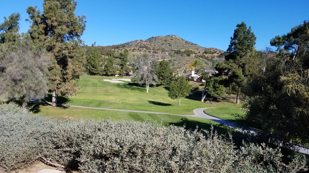
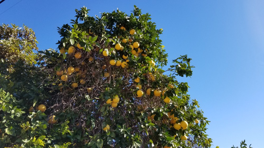
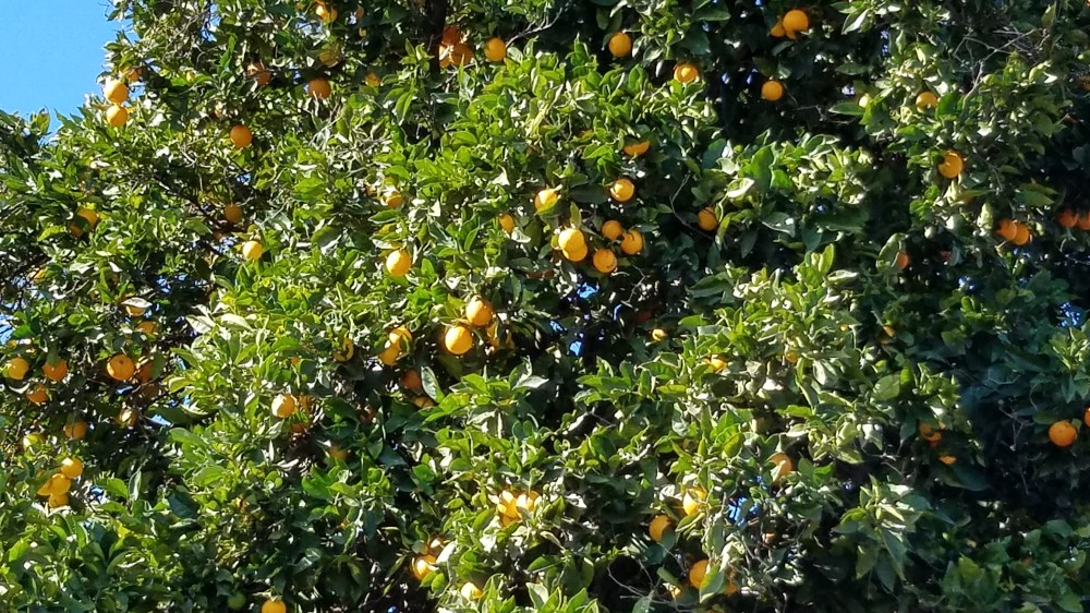
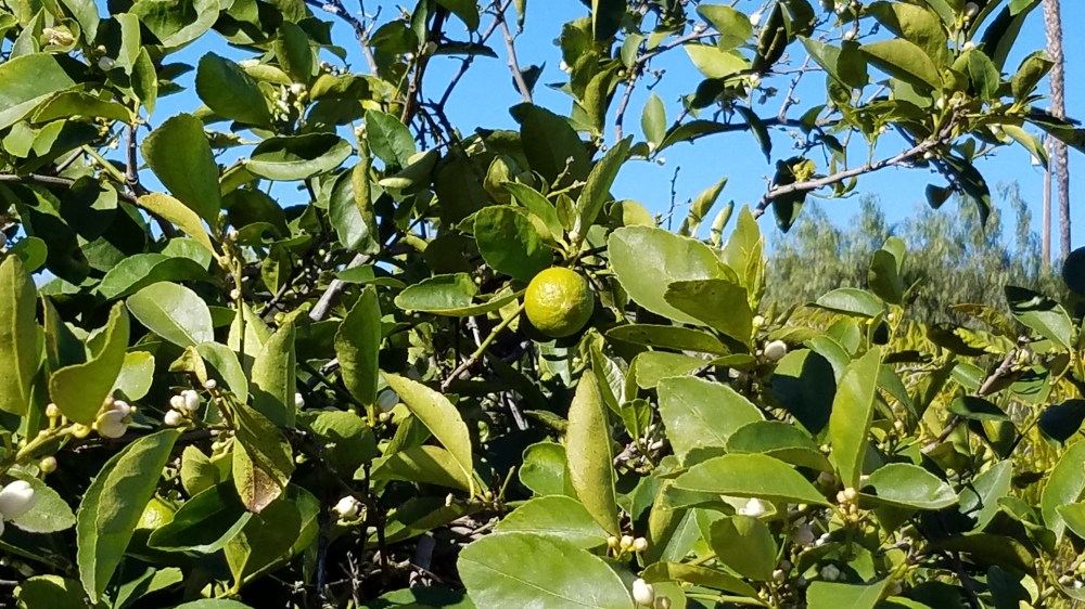
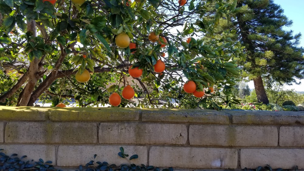
This day could have also been called the Mountain Grove Tour. I experienced riding through almost every kind of citrus grove you could imagine. Orange, tangerine, tangelo, lemon, lime, grapefruit and more were on this trail. More than anything else, there were always avocado trees in sight wherever I peddled as this is where the majority of the USA avocados are grown.
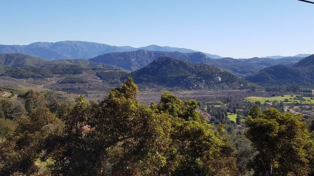
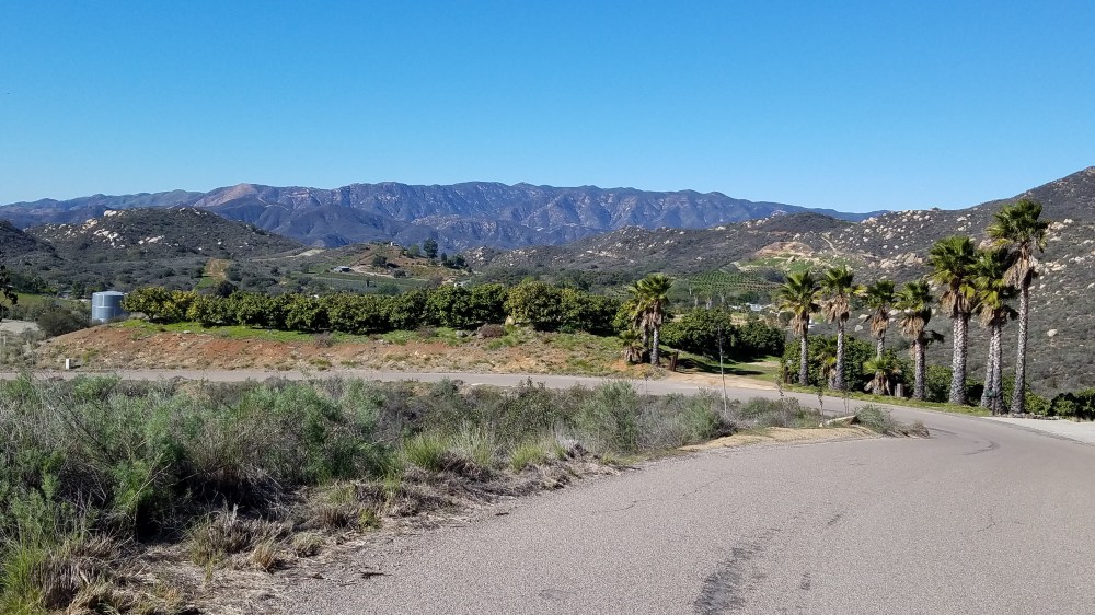
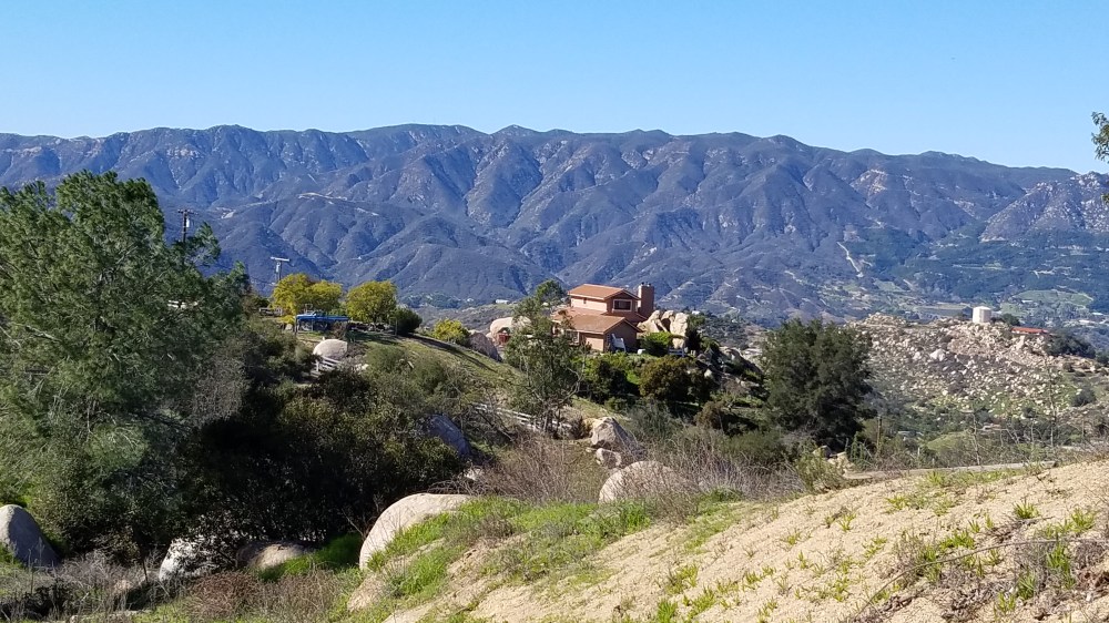
The initial ascent South of Fallbrook took me through a mixture of residential, small ranches and a few larger grove operations. Often with views like this of Palomar Mountain as I went higher and higher.
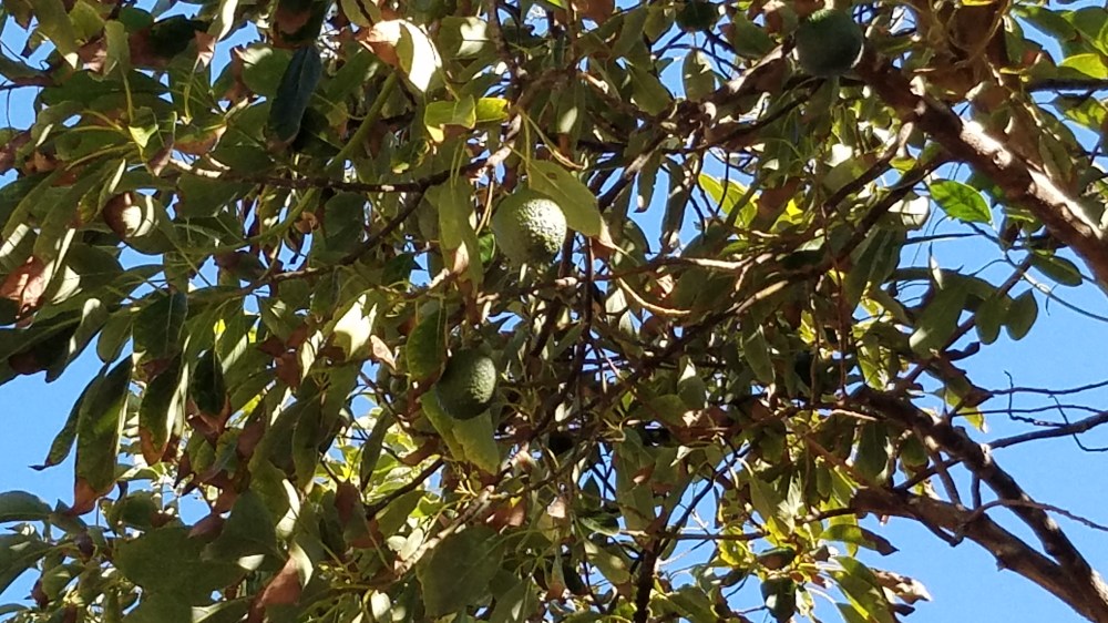
The avocado groves throughout this entire tour were often thick with their green, creamy goodness and flank me for miles on each side of the road as can be seen in this photo.
Smorg worked hard on this route because the last few miles were off the grid on private single lane roads maintained by small ranches. Smorg did deliver all pavement for me though. No dirt. Good Smorg. As the last bit of the winding, and often confusing, intersecting private single lane roads came to the narrowest one I descended to Reche Road which would take me toward Fallbrook.
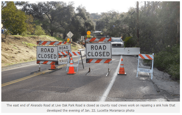
The next mile and a half was on a busier stretch than I normally enjoy without much of a shoulder before I turned onto the beautiful Live Oak Rd. It is one of those lonely roads that has a canopy of oaks covering it for the majority of the span. This was short lived as I was supposed to make a left on Alvarado. To my surprise, Alvarado had disappeared. The recent rains took out the bridge.
I pulled over to assess my situation across the from Alvarado on a street that appeared to be self named as Hobbit Lane. As I began to look over my options on the map on my phone, one of the Hobbits had rolled down the street in his late model Chevy Malibu. A chatty Hobbit, he rolled down his window and told me the whole history of how many times the bridge has gone out in the last twenty years, how they throw junk in it like bicycles and shopping carts and then cover it all up with gravel and pave it again. Not that I asked. 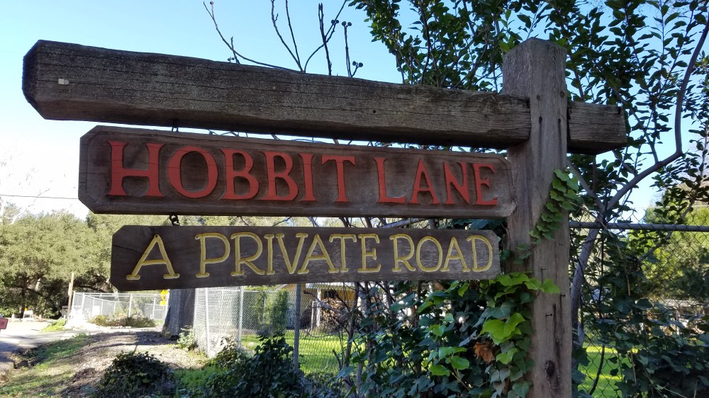
After receiving this local road improvement lore, I asked him if he knew how to get around it. “Sure,” he said. “You just to up to Gumtree Lane and turn left, then turn left again at Stage Coach Road.” Now it was getting a little weird. I am on Hobbit Lane getting directions like I was trying to make my way through Candyland. The Hobbit seemed confident of these directions though so I thanked him, bid him a good day in The Shire and peddled off. Sure enough, his navigation to the gateway of the Fallbrook version of the Tower Hills was right on.
Once I was back on track, I was basically in the town of Fallbrook and went right through downtown. Only a few blocks long, I was quickly on my way to a winding descent down De Luz Rd that left behind any form of residential congestion quickly and entered the Santa Margarita Preserve. Once across the Santa Margarita River, I would find that my climbing legs would be needed for a seemingly endless time from here on out until the descent into Temecula.
I found that this stretch of De Luz Rd was well paved with a nice shoulder for cyclists. In no time, I was being passed by a group I call The Grays. They weren’t aliens, but they were definitely part of some sort of cycling club and they were all wearing the same kind of gray cycling wardrobe. A few more minutes later, more Grays passed me too.
At the top of this summit, The Grays had taken a break and I almost caught up to them. However, just when I pulled up to them they descended leaving me to my Ride With GPS female voice navigator telling me that I would not be joining the pack. Instead, I was instructed to go up more. Instead of hanging with the freewheeling Grays flying down De Luz Rd, I would be cranking up something called Harris Spur Truck Trail.
I took her advice and was rewarded with amazing views, virtually no cars, and all the avocado groves I could ever imagine. I was truly in Avoland now. There were huge avocado grove operations everywhere I looked and more being planted.
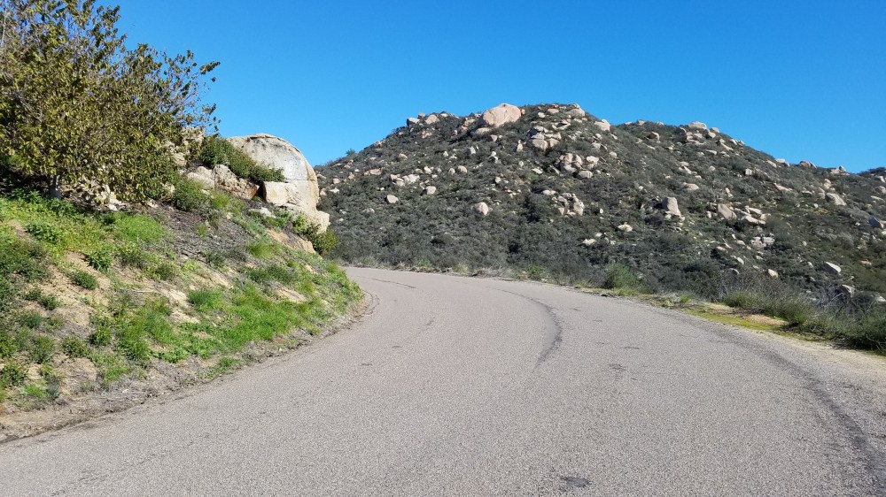
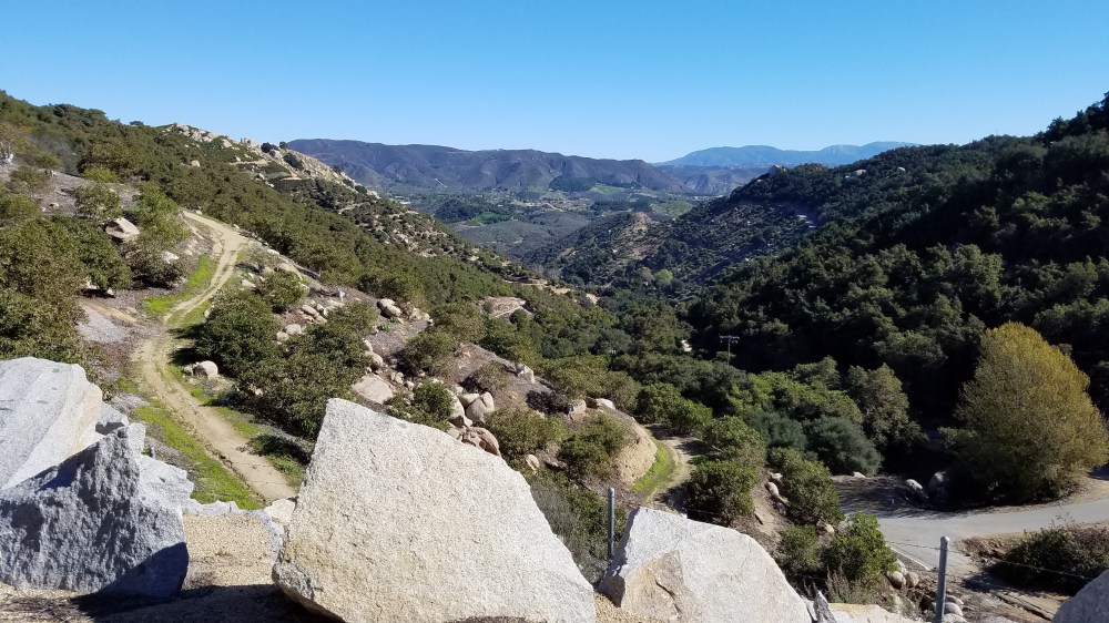
The Harris Spur Truck Trail, and connecting De Luz Heights Rd, ended up being a three mile constant climb and it was my kind of climb. No cars, views forever like you see below, and challenging. I will be back and I might even bring friends.
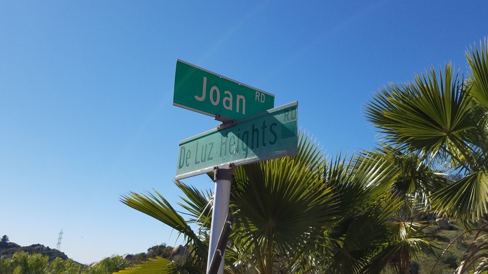
At the end of the climb where the road intersects Joan Rd I was rewarded with this additionally incredible view back to where I had ascended from.
Although this has been exceptionally fun, I began to wonder where I was and how long this would take. I was now 30 miles into the ride to my astonishment. Generally, at 30 miles I would be in Temecula by now with a lot less climbing. I kept wondering how long it would take to turn left and head for town? I found I would wonder for some time yet before that happened.
At Joan Rd there was a descent. Maybe this is where we turn right? The answer was yes, but not THE right I was looking for. This was the right to climb even more I was to discover. This literally continue for another 9 miles! 9 amazing miles though as you can see here.
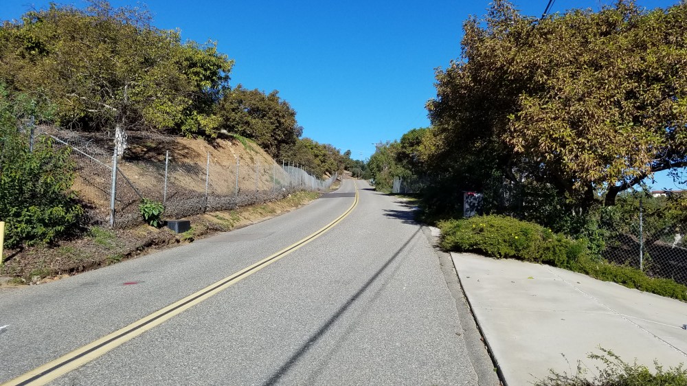
Finally, I turned right on Rancho California Rd which I knew was my ticket to downtown Temecula. There was still more climbing ahead of me, but on a much more gradual grade and a pleasing bike shoulder since this was a more traveled road.
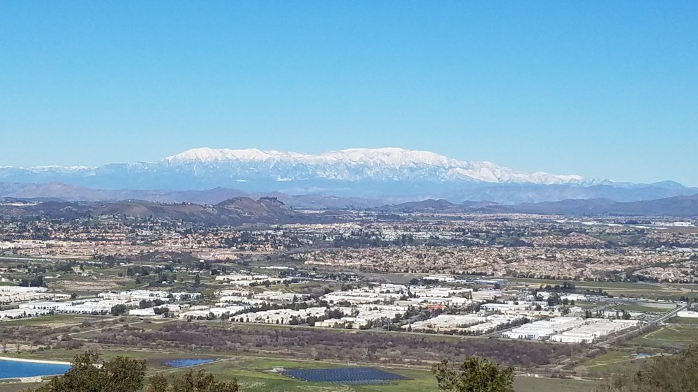
As I finally hit the summit, another fantastic panorama came into view. The weeks of cold weather, and precipitation, had blanketed the San Bernardino Mountains with thick snow. It was a very clear day and they loomed in the background of Temecula from my vantage point above the valley.
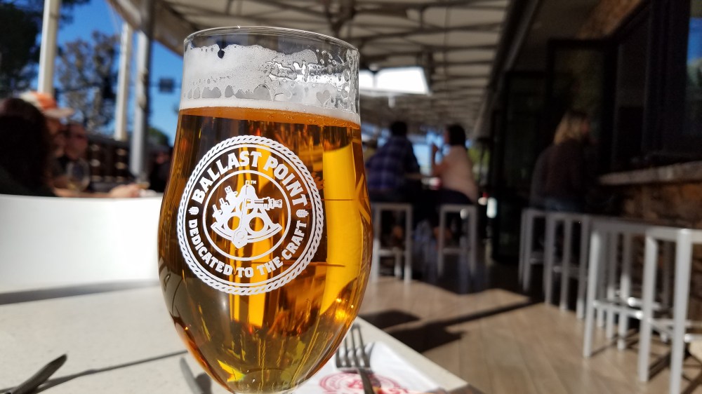
All that climbing makes a boy hungry. As I descended into Temecula I noticed on Ride With GPS that I had now ridden 47 miles and climbed over 4,700 feet. I knew directly in front of me would be Ballast Point Brewing offering me carb loaded beverages and quality grub. It was an easy decision. A reward for my hard work was now inevitable.
A cycling friendly joint, I parked my bike on the patio and made my order. A refreshing pint of Kolsch and some fish tacos. I have had a lot of fish tacos in my life and this day made them taste like they were the best fish tacos ever.
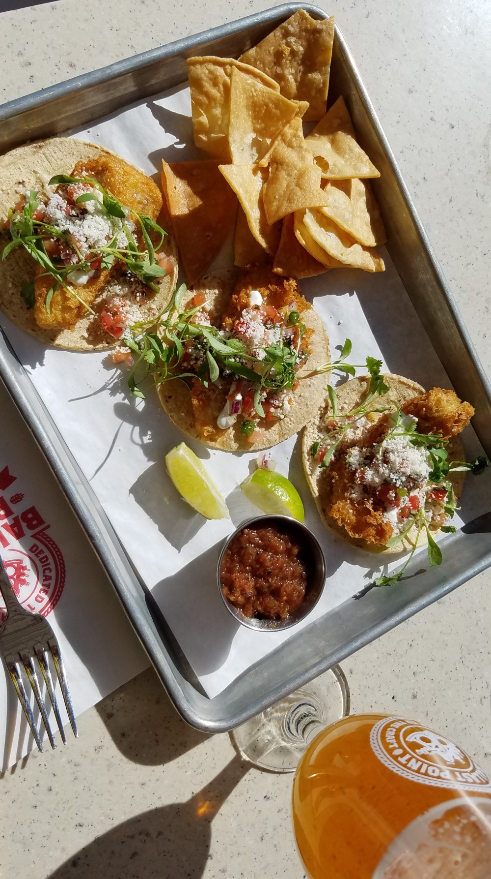
I savored my meal knowing I had 30 miles to get home yet. I told myself it wouldn’t be so bad. I like to lie to myself like that. My theory is that I listen to myself more than others so if I tell myself a lie like that I might actually believe it. There were only two hard climbs and half of it would be long downhills. Thanks to that fine brew, and fish taco fuel, I was pleased to find it was quite a comfortable ride back.
Totals for the day included 77 miles, 8,300 feet of climbing, too many avocados to count, endless amazing views, one refreshing pint of Kolsch, three glorious fish tacos, a ride I will always remember, and a ride I will do again.

